VRDigs Official Logo

Property Measurement Services for Landscaping


Get Accurate Property Measurements with 2D Mapping Technology

Property Measurement Services

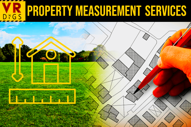
Property Measurement Services are an ideal way to accurately capture measurements of your property in order to create CAD drawings and 2D maps that can be used for 3D landscape design and planning.


If you don’t have the tools or time to do this yourself, Property Measurement Services are a quick and easy way to quickly get high-quality drawings that will allow you to complete the next phase of your project in record time.

Request Measurement

Create an Accurate Bird's Eye View 2D Map

Local property measurement services help quickly and accurately create 2D CAD drawings of your property. You can then use these drawings as a starting template for our 3D virtual landscape design services.


You are also free to use these drawings for your own landscaping or outdoor construction planning. Use dimensions to estimate materials costs or quickly and easily forward this information with prospective landscaping contractors to streamline communication and project expectations.


You can even share these drawings with real estate contacts, or anyone else that may benefit from knowing the accurate measurements of irregularly shaped portions of your outdoor spaces.

Request Measurement
  • What are the benefits of using local property measurement services?

    Local property measurement services are a great resource for those looking to create CAD drawings for their property. Whether you're looking to update your backyard or find out how much room is available on your back porch, these measurements can help determine the costs of materials. 


    We are also glad to provide these 2D drawings to any outdoor contractor to use for their own estimates and planning.


    This new measurement system is fast and accurate, free of the time and errors that can come from measuring an outdoor space by hand and manually drawing it.


  • What type of measurements can be taken?

    Local property measurement services help quickly and accurately create CAD drawings for your property. Use these drawings as the basis for our 3D landscape design services as a starting template. 


    With this type of scan, you get an accurate 2D drawing of your property that you can use for a variety of purposes, such as Virtual Landscape Design.


  • How does this compare to other methods of measuring property?

    It's important to note that while VRDigs measurement process can indeed give you a detailed 2D map of your property, it is not meant to replace actual land surveying services. Our drawings of your property DO NOT qualify as land surveys for legal purposes. If you require a land survey, you will still need to contact an officially licensed land surveying company in your area.

Share by: